
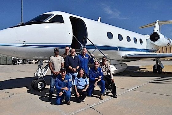
A decade-long project, which is currently in its second year, will include NASA traversing the Canadian skies this summer in an effort to study the impact of climate change on Arctic and Boreal ecosystems. The federal government and Canadian universities will lend their assistance. Aircrafts have already taken flight. Scientists aboard these flights became concerned while monitoring the levels of carbon dioxide, carbon monoxide, and methane in the atmosphere.
According to Goddard Space Flight Centre’s chief support scientist, Dr. Peter Griffith, the main goal of this project “is to better understand the impacts on ecosystems and on society of the rapid environment change that’s occurring in the Arctic-Boreal region of North America.” He went on to say that integrating fieldwork with airborne observations will allow them to better understand how things are happening across a broader region.

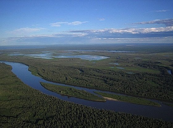
ABOVE project monitors earth and its resources
The project, known as ABoVE, will make use of several instruments designed to monitor the earth and its resources, functions, etc. The Airborne Microwave Observatory of Subcanopy and Subsurface(AirMOSS) and the Uninhabited Aerial Vehicle Synthetic Aperture Radar (UAVSAR). AirMOSS observes root-zone soil moisture to determine its control over carbon fluxes. UAVSAR sends and receives radio waves in order to gain information about features on earth such as earthquakes, volcanoes, hydrology, vegetation, and more. These two instruments will study soil to determine the amount of moisture, whether the soil is frozen, and the depth of thawed soil. By making multiple flights through the same areas, they will be able to monitor how these areas change over time, which will go a long way in informing scientists on the state of the environment currently as well as the extent of the threat imposed by climate change.
The Land, Vegetation, and Ice Sensor (LVIS) is a laser altimeter that is flown over target areas to scan and collect data. The LVIS measures vegetation structure and topography. It will monitor the effect of temperatures on forests, as well as how thawing permafrost changes surface heights. The Airborne Visible/Infrared Imaging Spectrometer – Next Generation (AVIRIS-NG) was developed to access “high signal-to-noise ratio imaging spectroscopy measurements in the solar reflected spectral range.” It will collect information on 224 wavelengths, allowing scientists to gather data on atmospheric conditions.
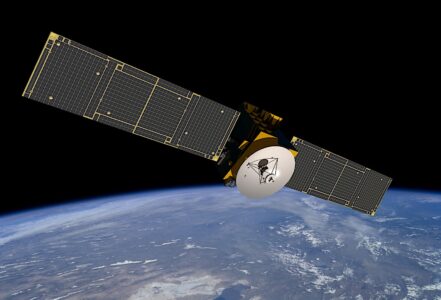
Additionally, another topography radar instrument will be of use in this project. The Airborne Surface Water and Ocean Topography (AirSWOT) is performing engineering test and measurement validation flights. The AirSWOT, originally designed for the SWOT satellite mission, will be used on NASA AFRC’s B-200 aircraft. Upon its launch in 2021, it will measure the extent of surface water.
The Atmospheric Carbon (ATM-C) instrument will be employed on Scientific Aviation’s Mooney aircraft in order to measure carbon gases in the air surrounding the plane, as well as study “the exchange of carbon between the atmosphere and ground.” The Chlorophyll Fluorescence Imaging Spectrometer (CFIS) studies the temporal variability of solar-induced fluorescence emission over a period of time. Aboard the Twin Otter International’s DHC6 aircraft, the CFIS will study the chlorophyll in leaves and the way it fluoresces when it captures energy from sunlight and use that data to estimate the total growth rate of plants in the area.
The Active Sensing of CO2 Emissions over Nights, Days, and Seasons (ASCENDS) has the capability to predict and model long-term changes in the climate cycle and provide long-term data using a multi-frequency laser to measure CO2 in the atmosphere. It will gather information and test new approaches that could be used in an upcoming satellite mission.
Over 500 researchers and staff are involved in ABoVE, and the data collected in this project may serve as a baseline to future efforts.
Instruments collecting data for ABoVE this summer, mostly flying out of Fairbanks, Alaska and Yellowknife, Canada are:
- The Airborne Microwave Observatory of Subcanopy and Subsurface (AirMOSS) instrument, on NASA’s Johnson Space Center’s G-III aircraft, and the Uninhabited Aerial Vehicle Synthetic Aperture Radar (UAVSAR), on NASA’s Armstrong Flight Research Center’s C-20A aircraft. Both radar instruments will study soils – measuring the soil moisture, whether the soil is frozen, and the depth of the thawed soil.
- The Land, Vegetation and Ice Sensor (LVIS) on Dynamic Aviation’s B200T aircraft. LVIS is a lidar instrument that measures vegetation structure and ground topography, and, together with other data, will allow scientists to study how warming temperatures change the make-up and extent of forests, and how thawing permafrost changes the surface heights.
- The Airborne Visible/Infrared Imaging Spectrometer (AVIRIS-NG) on Dynamic Aviation’s B200 aircraft. AVIRIS is an imaging spectrometer that collects information on 224 wavelengths, allowing scientists to gather data on vegetation health and atmospheric features including methane plumes.
- The Airborne Surface Water and Ocean Topography (AirSWOT) radar instrument on NASA AFRC’s B-200 aircraft. AirSWOT, a test bed instrument for the planned SWOT satellite mission, slated to launch in 2021, will measure the extent of surface water, including over the Arctic regions where lakes sometimes cover half of the landscape.
- The Atmospheric Carbon (ATM-C) instrument suite, on Scientific Aviation’s Mooney aircraft. ATM-C will measure carbon gases – carbon dioxide, methane and carbon monoxide – in the air around the plane, informing ongoing studies of the exchange of carbon between the atmosphere and ground.
- The Chlorophyll Fluorescence Imaging Spectrometer (CFIS) on Twin Otter International’s DHC6 aircraft. CFIS is a new instrument that will use a feature of plant physiology – the chlorophyll in leaves fluoresces when it captures energy from sunlight– to estimate the total growth rate of plants in an area.
- The Active Sensing of CO2 Emissions over Nights, Days, and Seasons (ASCENDS) instrument suite on NASA AFRC’s DC-8 aircraft. Multiple instruments will measure carbon dioxide in the atmospheric column, gathering data as well as testing new approaches that could be used in an upcoming satellite mission.


